Shallow Bay
 Before the highway was built, mail carriers had to travel on foot and by dogteam in winter, between the scattered fishing settlements along this coast. A section of the Old Mill Road has been turned into a trail at Shallow Bay , linking the day use area to the campground. It runs north through the campground just behind the beach dunes, then crosses the Slants River .
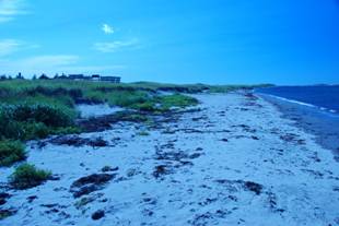
 For most of its length the trail passes through a dense forest of dwarfed white spruce and balsam fir. The board walk crosses the dunes to the beach. This raised path protects the vital dune-stabilizing grasses. Shallow Bay has the most extensive sand beach in the park and on warm days is pleasant place to swim. Dune grass is quickly killed by trampling and when it is gone wind destroys the dunes.
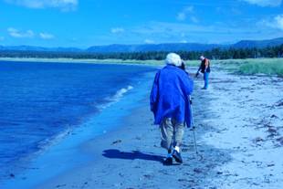
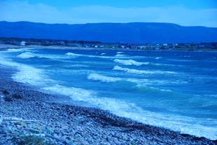
 We arrived at Cow Head well after two pm and stopped at the recommended restaurant on the Bay. The food was fine but the service was miserably slow and of poor quality. Shallow Bay motel had a very dark windowless pub, so we opted for the ocean view dining room. After lunch we ventured on to the beach at Shallow Bay for a windy walk.
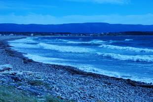
The terrain was a little rough for mom so I was glad we had her cane. Jacques Cartier sailed past here in 1534 and named it Cap Pointu . Outwards, closing the bay are the Belldowns islands. Fossil beaches in ma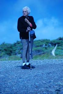 rine gravel and terraces form the rugged landwash . Some more exploring around Cow Head, but we didn't venture out to the lighthouse. A brief stop at Broom point netted no pictures, we were not adventurous enough to head through the tuck and I could tell mom was not up for a walk.
Broom Point
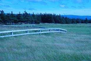
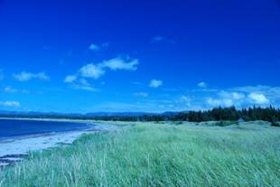
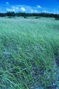
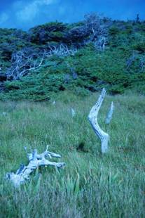
This trail is a corridor through twisted tuckamore . The spruce and fir have been a pruned and stunted by winter desiccation, salt spray and st ron g cold winds. The coastal meadow overlooks the mouth of Western Brook. There is a panorama of the sweeping beach backed by the tall sand dunes and the Long Range escarpment in the distance.
 This area is rich in cultural heritage. Palaeo -Eskimos built seasonal camps near here more than 2500 years ago. They hunted se mammals, fish, and birds offshore. More recently an Indian culture occupied this site. Early residents of Broom Point and Gull Marsh are buried in a graveyard at Sandy Cove. The 1960's fishing station at Broom Point has interpreted the coastal lifestyle.
We turned back after a few hundred feet. Looking behind us we could see the light at Western Brook was more pleasing as the clouds had dispersed.
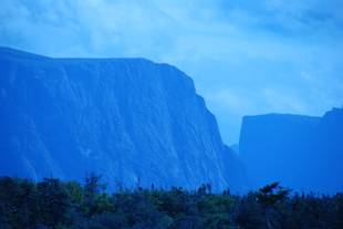
Once again, we stopped at Western Brook Pond trailhead for some photos. Oh my my . What a sight. Low clouds, blue grey, green, and purple. I can't believe that I am here to see this. I have dreamed of this sight. I don't want to move from this spot. I keep watching to see the light changing. It moves in and out of the clouds, highlighting and shadowing the gigantic cliffs of the gneiss fjords. In f ron t of me is the peat and muck that form bogs and fens, which overlay the limestone bedrock. Mounds and ridges of till 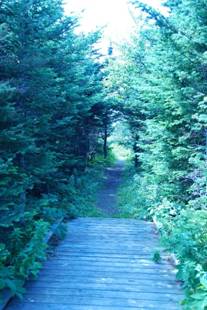 blanket the sandstone that was formed in deep water and pushed here many thousands of years ago. It was some time about now that I realized my camera has reverted to some obscure white balance and was set for incandescent light. Well, the shade of blue in my pictures is spectacularly eerie. It's time to learn some Photoshop techniques. This is the second time we stopped at this trailhead the sky has cleared and the sun is shining on the north face of the cliffs. These are all new colours , a little more rust and the deep etched cliffs become more prominent.
Western Brook Pond
This is the most popular feature in the park. The trail crosses the wetlands separated by low forested limestone ridges. The boardwalk and trail protect the wetlands from damage and keep walkers dry. The wetlands are alive with low-growing plants including wild orchids, irises, bakeapple , cranberry and a variety of heaths. Also of interest are the insect trapping plants such as bladderworts , pitcher plants and sundews. Moose feed in the bogs and forests along the trail and beavers inhabit the ponds and brooks.
The trail is a 3 km walk to the Pond but at 2km in there is a old trail that follows the bank of Western Brook. The 'steadies' along the old trail are great place to see waterfowl such as Black ducks and Green winged teal. This trail rejoins the new one. Three kilometres across the water are the cliffs guarding the entrance to Western Brook gorge. Sheer rock towers 650m above the Pond and plunges another 165m into it's crystal depths.
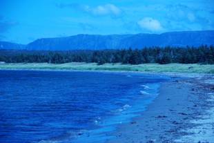
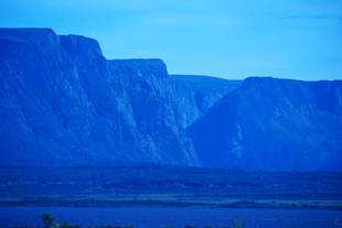
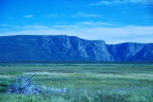 The valley pictured here is really a fjord. It was cut-off from the sea sometime after the last ice age!
Western Brook Pond was originally carved by rivers and repeated glaciations far back into the geological past. It was widened and over-deepened by glaciers which occupied the valley during the last ice age.
The last ice age ended some ten thousand years ago. During the one hundred thousand years the ice age lasted, the weight of the glaciers, some a kilometre or more thick, pushed the crust of the earth down into the mantle. When the glaciers melted, the sea flooded land and filled the valleys. With the weight now gone, the land slowly rebounded.
Western Brook Pond was once flooded by the sea. Now it is a deep lake nearly thirty kilometres long. It is separated from the sea by lowland. The lowland, the green flat area at the bottom of the picture, is made of various glacial deposits and beaches that developed along the rising shoreline.
Every few miles we see the warnings to watch for moose. We both call out 'watch for moose' partly to acknowledge the sign and partly to make note of how often we see the sign. Payoff! There's a moose feeding in the ditch, nose in the bush. I brake carefully after checking the rear view to make sure there's no one on my tail. I want to get a good view as well as ensure he doesn't turn and run into my path. There's no antler rack. I'm not sure if that means it's a female or just immature. Mom gets a good glimpse before I resume cruising speed. I would have liked to pull off but there is very little shoulder and we are on the truck route to and from St. Anthony. Posted 100kmh .
Time for a fill up. Rocky Harbour seems to be a good place to stop. We don't see much of the town but managed to find a few more groceries. Fresh apples and some real decaf Nescafé , albeit instant.
We settle for the standard quick fix dinner of crackers and cheese, tinned fruit and tea.
Tonight's show is Gail Anderson- Dargatz and Joel Hynes.