I have abandoned the electronic journal, since I can't get it to recognize my script. It's okay for note taking and reminders, but to do any serious journaling, it sucks.
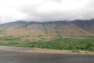
 So the drive into woody point was much improved over the night before. Although it was overcast with low clouds it was a sight to behold. On our right were the majestic red Tablelands, born out of the earth's mantle. It rises 700 metres above with a gentle concave slope. On the other side of the road in direct contrast the Gabbro rocks have the inverse convex slope. They are hard and domed but unlike the peridotite of the tablelands, the Gabbro can sustain botanical life. It is only 18kms between Trout River and Woody Point .
On a clear road it is 15 minutes. There are many trails and parking areas to stop and enjoy. Mom will become all too familiar with these. The trails in this are pretty rugged and not suited for Mom, so I guess we won't be doing any of these trails. I'll save her strength for St. John 's .
We took the rest of the afternoon to get ready for the evening's performance. Cheese crackers and a little fruit. Fruit comes in tins or jars, and all the milk is homo here. The shops are open to 11 pm but not the variety 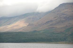 we are used to seeing.
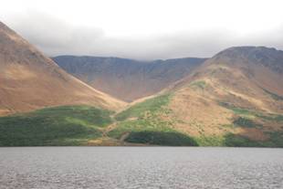
The Tablelands
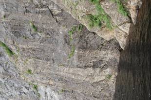
One of the reasons for the 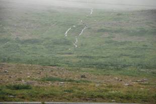 UNESCO World Heritage designation is the spectacular geology of the Tablelands. This rock from the Earth's mantle records time when the continents of Eurasia and North America collided. These rocks formed far beneath the ocean floor and were transported to their present position.
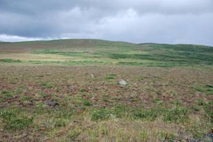
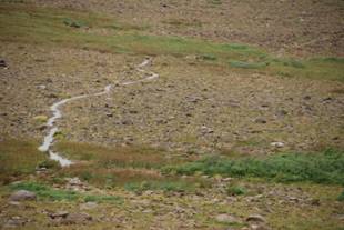
This type of rock ( peridotite ) is rar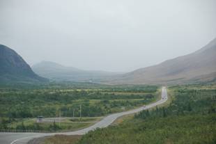 e at the earth's surface and is unsuitable to most plants. The unusual flora of this area is sparse and stunted, in contrast to the forested slopes on the north side of the highway. Those who explore off the beaten path should take care to avoid damaging the slow growing plants. The hillsides are unstable and can be dangerous to climb. Distances are difficult to judge. Most things are twice as far away and twice as high as they appear. There are no landmarks or shelter atop the plateau. The slopes are steep and it is a long way down.
Because these rocks and soil are hi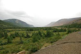 gh in i ron and magnesium, most plants cannot grow on the Tablelands
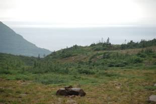
Trout River Pond.
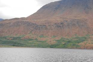
Gros Morne is known for its spectacular land locked fjords, or 'fjord ponds' which were carved from the Long Range plateau by glaciers. Along the north shore of Trout River the trail passes through meadows and scrubby forest. It then strikes out across the rock barrens of the Tablelands. The trail crosses many intermittent streams. After a rain the runoff is heavy, due to sparse vegetation but it can be stepped over most times. While we were here this was very evident as we found some very heavy rainfalls. Along the trail contorted, stunted trees and shrubs have eked out an existence for hundreds of years. The two ponds join along a curving spit and beach at the Narrows . Beyond we see the Big Pond lying in a glacial valley. The bedrock's influence on the vegetation is striking as we see on the north side of the pond, the barren sloes of the tablelands, while the hills to the south are of a different rock ( gabbro ) and green with life.
 While we visited here there was a gentleman that became disoriented and missed his check in spot. He was found two days later, dehydrated but uninjured.
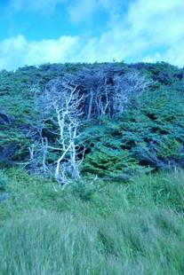 Tuckamore or Tuck is a Newfoundland term for dense, dwarfed and contorted spruce-fir forest that grows in exposed locations along the coast on the flanks and tops of the mountains.
Pond is used in Newfoundland to refer to freshwater bodies of all sizes. Gros Morne's ponds range from the size of a beaver impoundment to 16 km long, 165 m deep Western Brook Pond.
Heath is a wiry, knee high, shrubby growth that covers open areas. It consists of plants such as leatherleaf , rhodora bog laurel and blueberry.
Gros Morne became a national park in 1973. It protects some of the most spectacular scenery and wildlife in eastern Canada . The park maintains about 75 km of trails, not including the long unmarked traverses.