In 1807 talks began to strengthen the defense of St. John s because of the trade restrictions. So in 1811 they again decided to rebuild the battery to make it st ron ger in doing this they constructed two more 18-pound car ron ades and two more 6-pound cannons. Between 1812 and 1814 one officer and six gunners manned the site.
In 1967 the battery was reconstructed by the 56th Field Squad ron of the Royal Canadian Engineers and the Newfoundland Government as a centennial project.
Today, the battery is open to the general public for tours. It also follows a duty schedule in which the men who manned it years ago in history would have done daily. The cannons are also shot off twice a day.
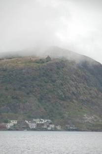
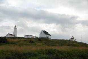
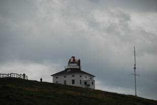
Fort Amherst is a small community within St. John 's , Newfoundland and Labrador on the southern side of "The Narrows", the entrance to St. John 's harbor. Apart from some family dwellings, Fort Amherst consists of a man-made harbor, a lighthouse and the remains of gun emplacements built during World War II to defend against German U-boats
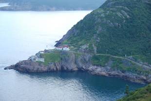
Fort Amherst , showing the lighthouse and WWII fortifications, as seen from Signal Hill
The original fortifications at Fort Amherst , built in the 1770s, are no longer visible. The fortifications were named for Jeffrey Amherst, 1st Ba ron Amherst, a British commander who played a significant role in the military history of North America . The name is shared with Port La- Joye / Fort Amherst in Prince Edward Island and Fort Amherst in England .
The first lighthouse in Newfoundland was built at Fort Amherst in 1810 .. The current lighthouse was built in 1951.
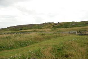
Signal Hill Because of its strategic placement overlooking the harbour , fortifications have been placed on the hill since the mid 1600s.
The final battle of the Seven Years' War in North America was fought in 1762 at the Battle of Signal Hill, in which the French surrendered St. John 's to the British under the command of Lt. Colonel William Amherst. Lt. Colonel Amherst renamed what was then known as "The Lookout" as "Signal Hill," because of the signalling that took place upon its summit from its flagmast . Flag communication between land and sea would take place there from the 1600s until 1960.
During Signal Hill's first construction period in the late 1700s, Signal Hill was designated as the citadel for St. John 's .
During the 1800s, Signal Hill was manned specifically during the Napoleonic Wars and the American Civil War. A second construction period in Signal Hill's history saw the construction of the Queen's Battery Barracks which, today, has been completely restored to the period of 1862.
Construction on Cabot Tower began in 1897 to commemorate Queen Victoria 's Diamond Jubilee in 1897 and the 400th anniversary of John Cabot's landfall in 1497. The building was declared officially open in 1900. The practical uses of the building were flag mast signalling , and a Marconi wireless station which has since been moved to St. John 's International Airport .
On December 12 1901, the first transatlantic wireless transmission was received here by Guglielmo Marconi in an abandoned fever and Diphtheria hospital, which has since been destroyed by fire The transmission originated from Cornwall .
The United States maintained anti-aircraft guns on the hill during World War II.
Today, Signal Hill is a Canadian National Historic Site and remains incredibly popular amongst tourists and locals alike; 97% of all tourists to St. John 's visit Signal Hill. Amongst its popular attractions are the Signal Hill Tattoo, showcasing the Royal Newfoundland Regiment of foot, circa 1795, and the North Head Trail which grants an impressive view of the Atlantic Ocean and the surrounding coast.
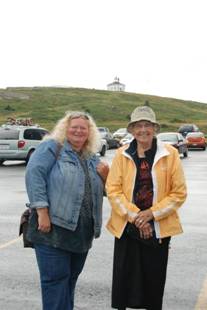
The road to Cape spear is narrower than the ones we encountered heading into Gros Morne Bush right up to the road edge, fairly Weinke . The view is spectacular you can clearly see the Cabot tower perched on the top signal Hill. It is much easier to pick out than Cape Spear from Signal Hill. The lighthouse is 175 steps from the parking lot. Sandy counted them. The risers are wide apart, with the step or two in between.
Cape Spear, located on the Avalon Peninsula near St. John 's, Newfoundland, is the easternmost point in Canada (52°37'W).
There is currently a dispute as to whether Cape Spear is the most easterly point in North America . While some consider Cape Spear to hold this title, others consider Nordost Rundingen , Greenland to hold the title.
The Portuguese named this location " Cabo da Esperança " which means "cape of hope", which became "Cap d'Espoir " in French and finally " Cape Spear ".
Cape Spear is the trailhead/trail end for two components of the East Coast Trail.
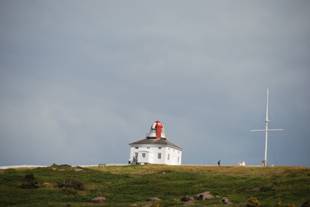
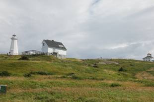
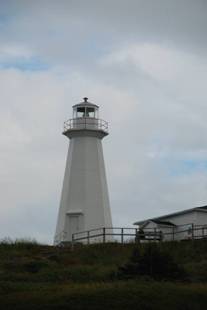
There has been a lighthouse operating at Cape Spear since September 1836. The original Cape Spear lighthouse was the second lighthouse built in Newfoundland ; the first was built in 1810 at Fort Amherst , at the entrance to St. John 's Harbour . In 1832, the first legislative assembly for the colony created a lighthouse board. Cape Spear was chosen as the site for a new lighthouse because it was on the rocky eastern coast near the entrance to St John 's harbour .
Construction began in 1834. The first lighthouse was a square wooden building with a tower in the middle containing the light. A fog horn was added in 1878. The first light used at Cape Spear had already been used since 1815 at a lighthouse at Inchkeith on the east coast of Scotland . This light used seven Argand burners and curved reflectors. This was later replaced by a dioptric lens system; the light was first lit by oil, then acetylene and finally electricity in 1930. The lighthouse has been restored to its original appearance and refurnished as a keepers's residence to the period of 1839. This is the oldest surviving lighthouse in Newfoundland . In 1955 it was replaced by a concrete tower nearby.
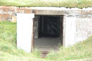
Because of its proximity to convoy routes during the Second World War, a gun battery was installed at Cape Spear to defend the entrance to St. John 's harbour . Barracks and underground passages leading to the bunkers were also built for the use of troops stationed there.
The location has been designated a Canadian National Historic Site. Cape Spear was also used recently for filming of a hockey game in the Canadian television series, Road Hockey Rumble.
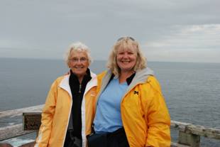


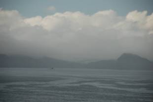
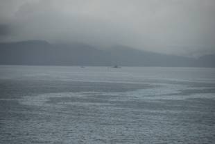
We do not venture up to the re creation of the 1836 keepers quarters, instead we strolled down to get closer look of the crashing waves. Mom was almost overcome by the emotion of being closer to Ireland than to home. She made phone calls to David back home and to Stephen in salt Spring, to praise my choice of vacationland. While we were looking out over the ocean we noticed a spec that turned out to be the HMCS Corner Brook. It is a submarine that was in St. John 's harbor only hours ago the sub had been on maneuvers in the Arctic in Iqualuit.