Lookout trail
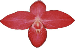
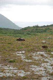
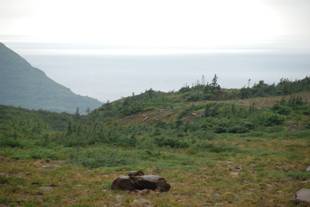
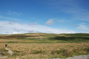
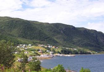
Partridgeberry hill is the rocky knoll above the community of Woody Point . It is one of the best viewpoints in the park. There is a panoramic view of Bonne Bay , Gros Morne and the Long Range Mts. A fire tower was maintained here until the 1970's on the plateau. The trail climbs through a forest offering a sample of most trees found in the park, including uncommon ones such as white pine and red maple. Above the tree line the gravel trail becomes a wooden boardwalk snaking across a wet meadow (fen) where pitcher plants and wild orchids grow. At summit we find a small platform with benches. The return loop crosses a barren of heath and caribou lichens.
 Since both Saturday and Sunday we would have performances twice a day that would not leave much time for sightseeing. I decided that today should be devoted to the trip to Cow Head. We left by noon; later than I planned. We made the journey back along 431 and 430 to Wiltondale where we turned north again along the north shore of Bonne Bay .
Peak a Tenerife
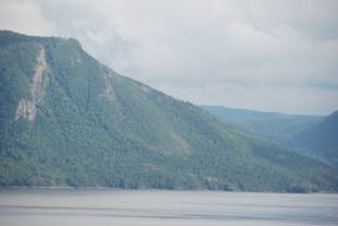
Located at Birchy Head, Pic a Tenerife is one of Newfoundland 's sharpest peaks. Known to the local people as 'pickatinyree', this strange name originated with Captain James Cook who sailed along the west coast of Newfoundland in 1768. He often named any features that he came upon after other areas that he previously had explored. In this particular case, this peak resembled the sharp point of Tenerife in the Canary Islands . Although Peak a Tenerife is not a major peak at 1850 ft, it has wonderful views, especially overlooking Bonne Bay and the Tablelands. It is easily accessible by snowshoes or snowmobiles in winter. Recently a back country ski chalet has been constructed near this peak thus making it an interesting winter hike.
 Snow lingers late into the summer on north facing slopes and in sheltered ravines. Footing can be treacherous on these steep icy slopes, it is easy to fall through where ice has melted from below.
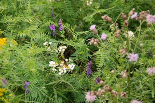
 Green gardens the most direct route to the coast is the Long pond section. It crosses the barren landscape of frost cracked orange-brown peridotite boulders. The trail rises to a view and rock type changes. The trail descends through the forest to the coast. Once in sight of the sea, the trail enters a long meadow from which stairs lead to the beach below. The main attraction is the coast. A large grotto has been carved from this rugged shore, other features include wide beaches with shallow rock pools, grassy meadows, rock pillars, wave cut platforms ancient sea-stacks and cliffs now raised high above sea level. The dark basalt cliffs of Green gardens are remnants of ancient islands. Pillow lava cliffs indicate undersea volcanic action; columnar joints in basalt nearby record above water lava flows. In places shards of dark lava shattered during cooling have been cemented into a matrix of white calcite. Green Gardens was used by the residents of Trout River as a summer range for their livestock and sheep are still seen here today. Because of the sheep's selective grazing, thistles form dense patches in the meadows. Wear long trousers.
 It was without regret that we stopped at every place that I saw an opportunity to take some pictures. The weather has been a curious thing. The skies were filled with cloud; white ones and dark grey ones, not really overcast. The clouds were filled with moisture that when the appropriate time came, let loose with a vengeance. It came down in torrents across the highway. The wipers could hardly keep up. Seconds later it was completely stopped and blue sky. This phenomenon was repeated every day and often. We made the requisite stop at the visitors centre for books maps and a pee. I have been searching for a book recommended by Ian, Come near at your peril- a visitors guide , buy Patrick o Flaherty but no one seems to have it. I'll keep looking.
James Callaghan Trail- Gros Morne Mountain 
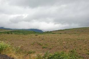
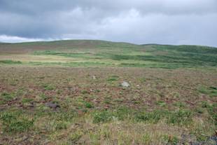
One of the most popular trails in the park climbs the mountain for which the park was named Gros Morne. This can be a gruelling hike. It starts near sea level, ascends more than 800 m and passes through forest, heath , and alpine barrens. The path climbs gradually through boreal forest where chickadees, warblers, and woodpeckers are often seen and heard. Near the mountain it passes through a heathy barren with several small ponds. At the base of Gros Morne the strenuous part of the hike begins. The trail rises steeply upward through a rock gully on the flank of the mountain. The mountain portion of the trail forms a loop, but for safety sake hikers should ascend the gully and use the Ferry Gulch route to return. Descending through the precipitous gully is very hard on the knees and can dislodge rocks on the hikers below.
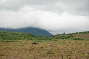
Caribou and arctic hare and rock ptarmigan are often seen on the flat tops of the mountain, while water pipits and horned larks nest among the rocks. The mountain top is surrounded by cliffs with few landmarks, so hikers should stay on the trail. This will also protect the slow growing mountain plants from trampling. Rock cairns built by the park mark a trail across the barren upland to the edge of a 600m drop where there is a spectacular view of Ten Mile Pond.
The Ferry Gulch descent on the eastern side of the mountain is marked by cairns and a staircase across particularly sensitive vegetation. Wind speed increases near the top of the mountain and it is often cold. There is no shelter on top and no water source. To protect vegetation the trail is closed in early summer until the gully is passable and the soil is dry enough to bear hikers. The trail is often closed at other times. A walk to the ponds at the base of rock gully makes a pleasant day hike and provides a beautiful view of the mountain, Ferry Gulch, and Bonne Bay .
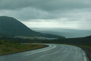
 The road around to Rocky Harbour was very windy with many steep grades, a bit more like I am used to in West Virginia . It was wider than we had recently and in better condition with a centre line and a yellow shoulder line. Unfortunately there still weren't any places to pull off. No look spots designated. In fact there was a spot near the bottom of a grade where a car was stopped three quarters of the way in the lane. Had they seen something on the shoulder? In my rear view I could other cars were topping too. Dangerous spot.